Today I came across a post on Alternet.org about the 2012 election and the divide between blue states and red states. The post suggest that the red/blue divide is among the slave state / free state divide during the troubled times of the Civil War. It presents a map similar to the one below as "proof".
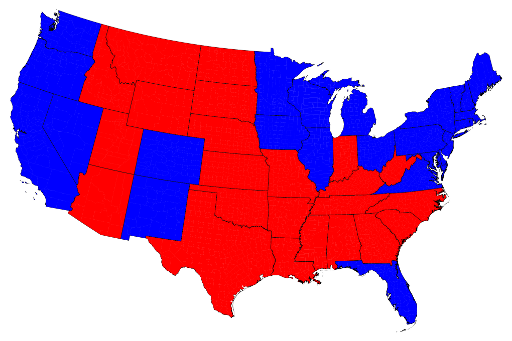
Basically they are dead wrong. Anyone who spent half a class awake during US History 101 knows that Florida was certainly part of the confederacy and was a "slave state". Virginia too. On the other hand, West Virginia and Indiana were part of the Union. Furthermore, everyone knows that election maps like the one pictured above are pretty misleading because they force states into an all or nothing disposition. This is how our electoral college system works, but it is not how our countries politics truly map out.

Here is the same data but shown by county, not by state. Clearly our countries politics are not drawn by social and political views that are 150 years old. If we were to do this on a smaller unit (perhaps census tract) we would find an even more purple country with no real dividing lines between red and blue.
The article is interesting, although odd, and the author tries to make a few attention grabbing points. It's worth the read, but ignore the titled and the graphics unless you want to be mislead.
